Driver-assistance Assessment of Safety and Hazards
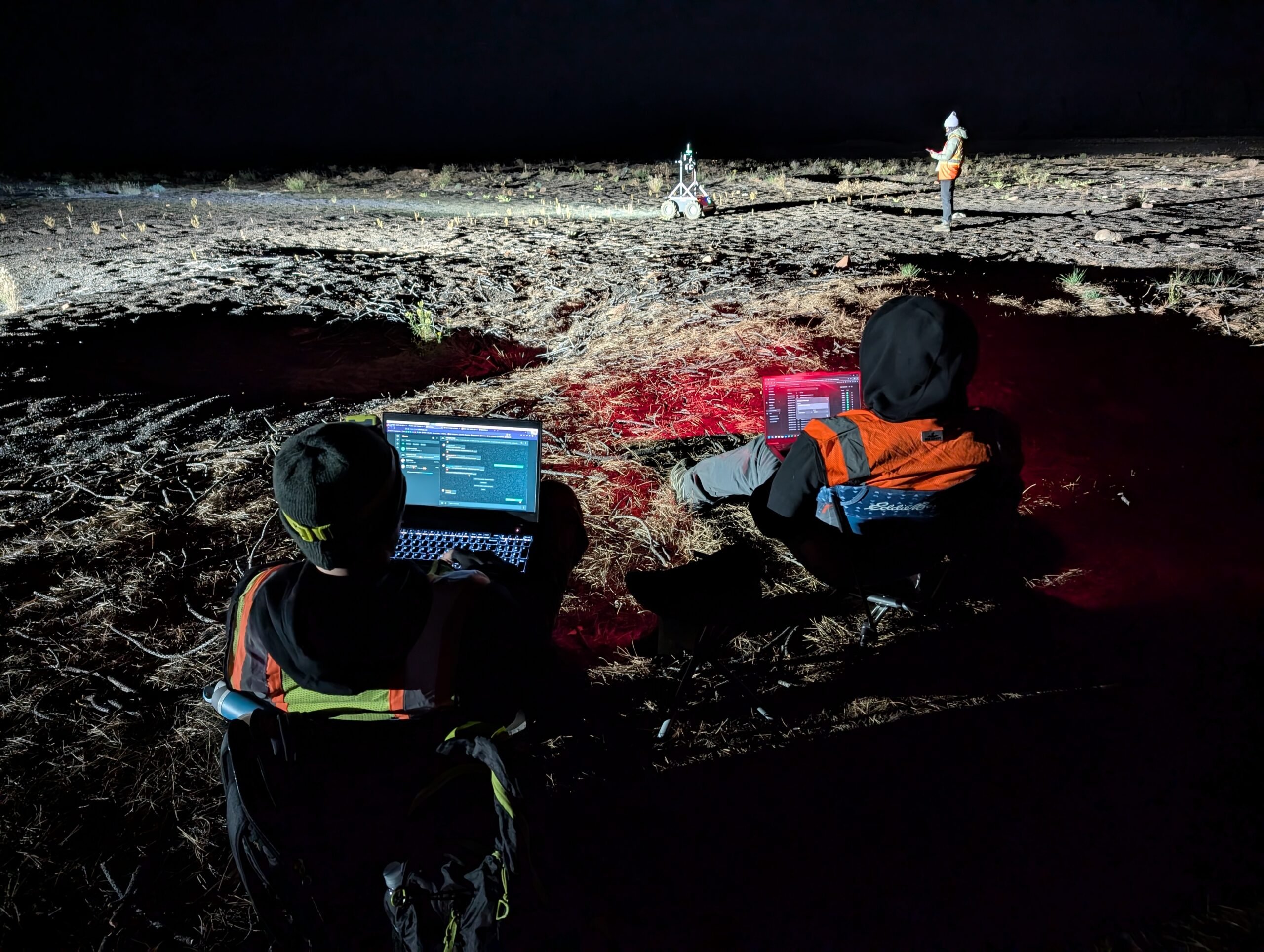
In 2021, Mission Control developed a terrain classifier to enable autonomous navigation for uncrewed ground vehicles (UGVs).
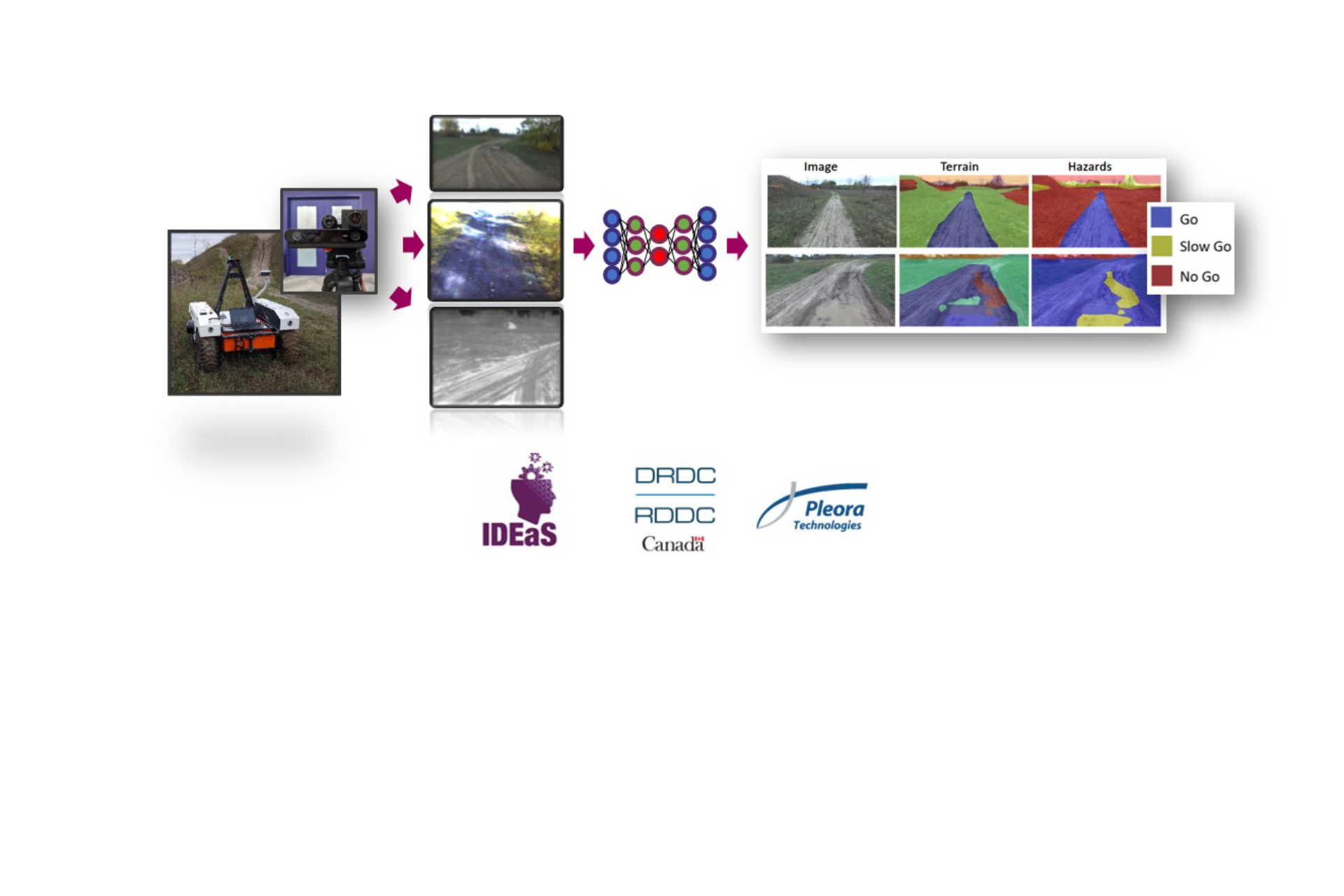
To address offroad mobility challenges for UGVs, Mission Control leveraged our Artificial Intelligence expertise to develop a Deep Learning model that can classify road hazards based on data from three different types of multi-spectral sensors in the visible and infrared range.
This project, Driver-assistance Assessment of Safety and Hazards, was funded by the Department of National Defense IDEaS program, and was completed in collaboration with Pleora Technologies.
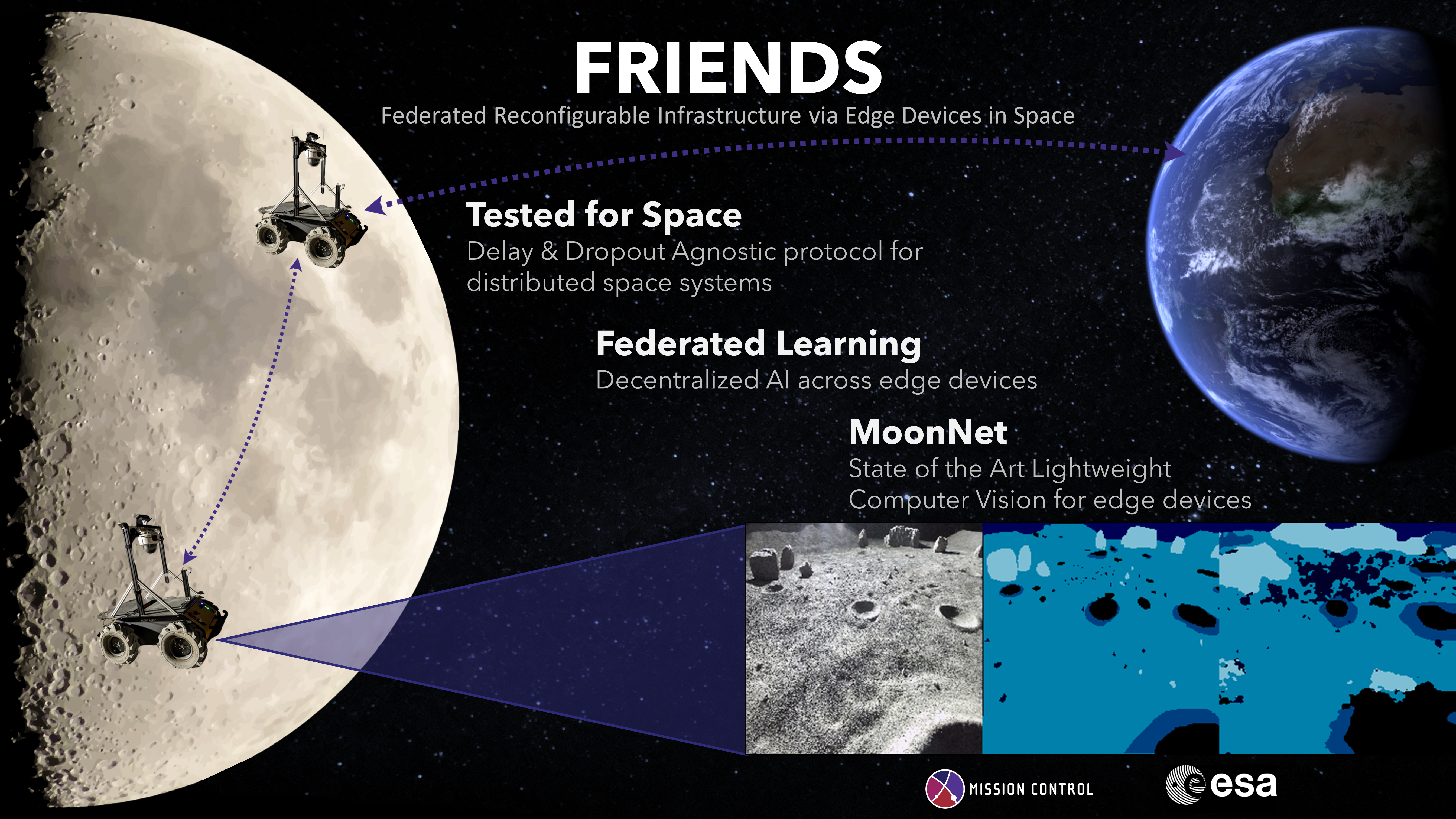
Our capability to rapidly classify datasets aggregated from multiple sensors is widely applicable to scientific and planetary exploration, Earth Observation, medical imaging, and other domains. In 2023, Mission Control became the first to deploy Deep Learning on a flight computer in a deep space environment, as our lunar terrain classifier MoonNet launched onboard the ispace M1 mission and reached lunar orbit, a milestone for autonomous exploration in deep space environments.
To learn more about how you can benefit from sensor fusion and deep learning methods to get actionable insights from multiple sensors and instruments, contact us today!